Utility Coordination
Presenter: Ashley Isaacson, P.E.
Organization: Bio Clean Environmental
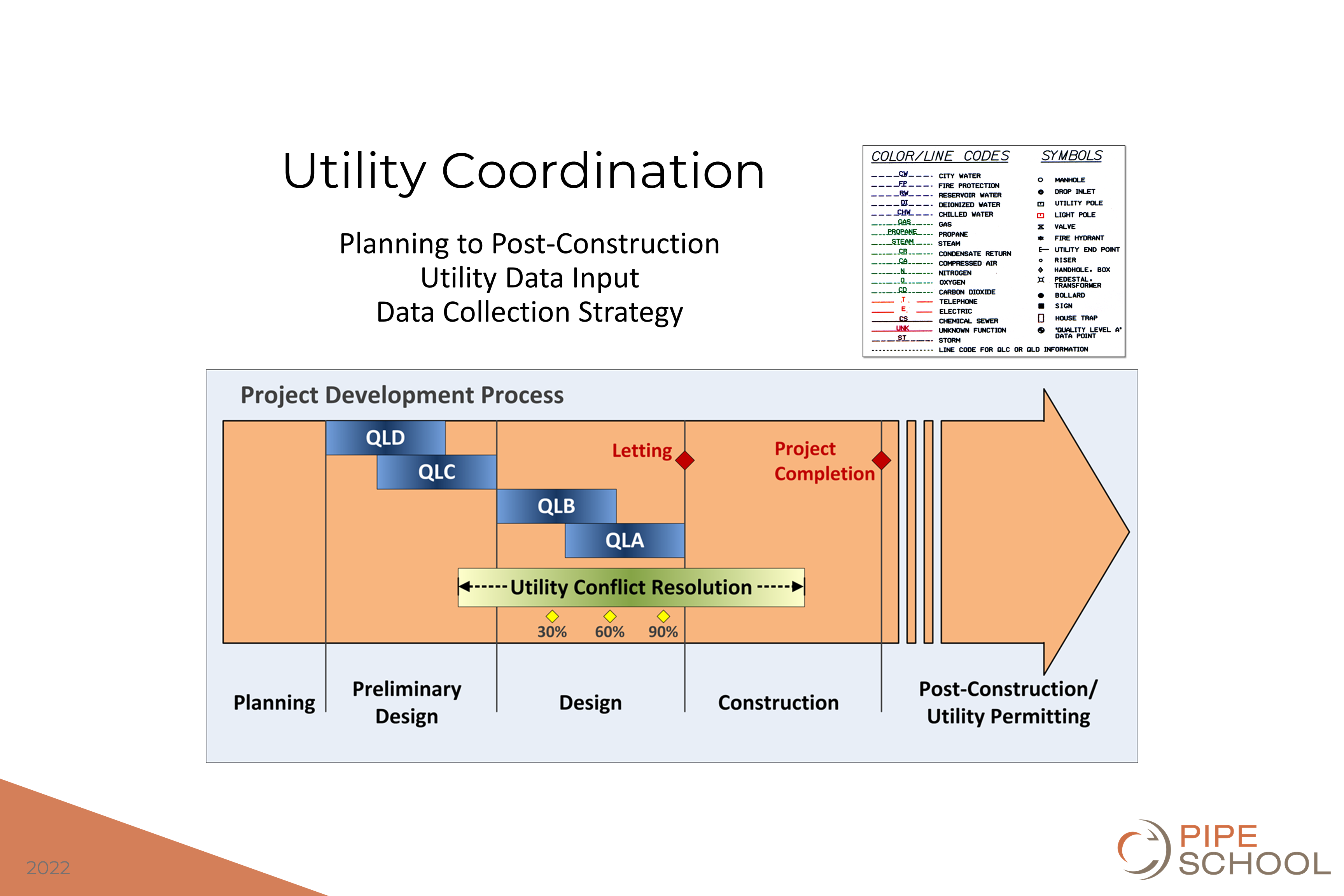
Description: Utility coordination is a process that takes place from the project planning stages to post-construction phases. The American Society of Civil Engineers (ASCE) Standard 38 defines four levels of utility data based on the quality and certainty of the data. In the project planning and preliminary design stages, QLD data Attribute is assigned to a Utility Segment or Utility Feature after review and compilation of existing records, oral recollections, One-Call or “private-locate” markings, managed data repositories, context with other achieved Utility Quality Levels, and/or other evidence of existence. QLD data is more uncertain than QLC, QLB, and QLA. QLD data is less uncertain than utilities documented without any Utility Quality Level barring a Professional’s statement of fact to the contrary.
QLC data is assigned QCC value to a Utility Segment not visible at the ground surface whose estimated position is judged through correlating Utility records or similar evidence to Utility Features, visible above and/or below ground.
In the more advanced design and construction document preparation stages, the project demands the use of QLB and QLA data. QLB is a value assigned to a Utility Segment or subsurface Utility Feature whose existence and horizontal position is based upon Geophysical Methods combined with professional judgment and whose location is tied to the Project Survey Datum. A QLB value is assigned to a Utility Segment when the following conditions are met: (a) the Utility Segment was detected through the application of appropriate Geophysical Methods; and (b) the geophysical signal was judged to be reliable; (c) the interpreted position was judged based upon knowledge and use of geophysical science, Utility design and installation practices, available records, visual features, and influence of site conditions; and (d) the source Designation has been tied to the Project Survey Datum with an accuracy of 0.2 feet horizontally.
The most certain of data, QLA, is a value assigned to that portion (x, y, and z geometry) of a Utility Segment or subsurface Utility Feature that is directly exposed and measured, and whose location and dimensions are tied to the Project Survey Datum.


